


BYRON - T 1 Voting District, Monroe County, Wisconsin
About
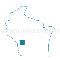
Outline

Summary
| Unique Area Identifier | 695654 |
| Name | BYRON - T 1 Voting District |
| County | Monroe County |
| State | Wisconsin |
| Area (square miles) | 18.06 |
| Land Area (square miles) | 17.54 |
| Water Area (square miles) | 0.52 |
| % of Land Area | 97.15 |
| % of Water Area | 2.85 |
| Latitude of the Internal Point | 44.04509620 |
| Longtitude of the Internal Point | -90.36383010 |
Maps


Graphs
Select a template below for downloading or customizing gragh for BYRON - T 1 Voting District, Monroe County, Wisconsin


Neighbors
Neighoring Voting District (by Name) Neighboring Voting District on the Map
- BYRON - T 2 Voting District, Monroe County, WI
- CUTLER - T 1 Voting District, Juneau County, WI
- LA GRANGE - T 2 Voting District, Monroe County, WI
- LA GRANGE - T 3 Voting District, Monroe County, WI
- LINCOLN - T 1 Voting District, Monroe County, WI
- SCOTT - T 1 Voting District, Monroe County, WI
- Wyeville - V 1 Voting District, Monroe County, WI
Top 10 Neighboring County Subdivision (by Population) Neighboring County Subdivision on the Map
- La Grange town, Monroe County, WI (2,007)
- Byron town, Monroe County, WI (1,342)
- Lincoln town, Monroe County, WI (835)
- Cutler town, Juneau County, WI (326)
- Wyeville village, Monroe County, WI (147)
- Scott town, Monroe County, WI (135)